Skip to content
James Cheshire
About
Blog
Teaching
Papers
Category:
Spatial Analysis
How England’s complicated political geography is confusing coronavirus rules
Aug 12, 2021
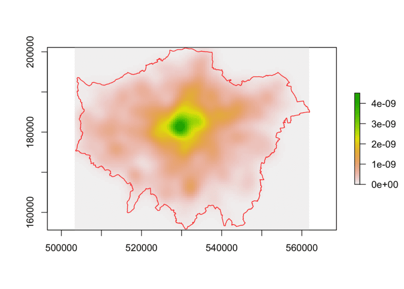
Point Pattern Analysis using Ecological Methods in R
Dec 12, 2017
Less is More: Data Visualisations for Big Data
Aug 10, 2017
Joy Division, Population Surfaces and Pioneering Electronic Cartography
Jul 28, 2017
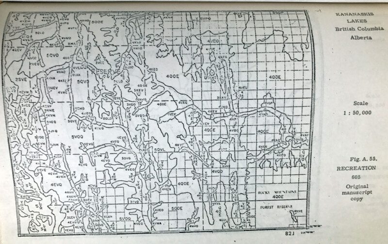
Roger Tomlinson's PhD: The first in GIS
Jul 12, 2017
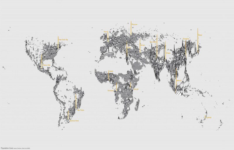
Population Lines: How and Why I Created It
Apr 27, 2017
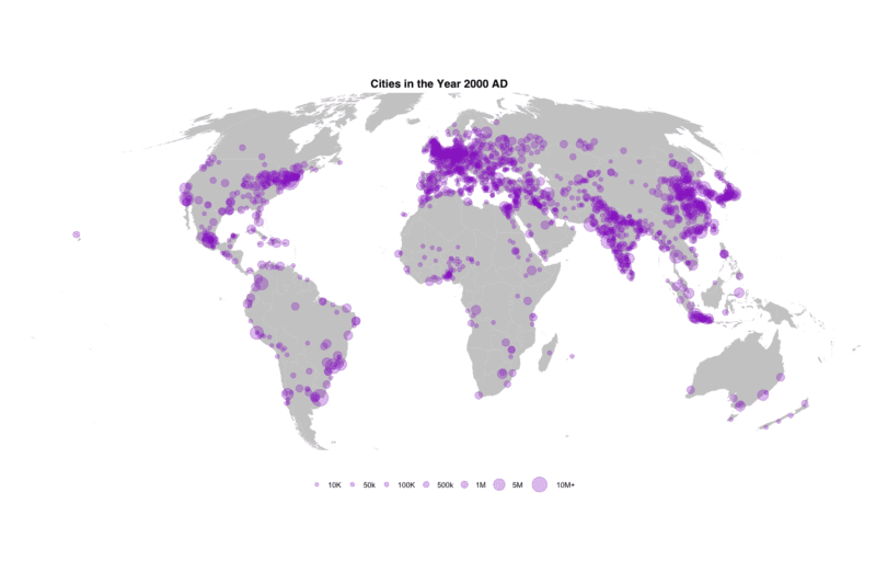
Mapping 5,000 Years of City Growth
Mar 6, 2017
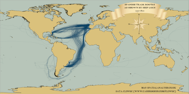
Mapping (historic) tracks in ggplot2
Oct 10, 2016
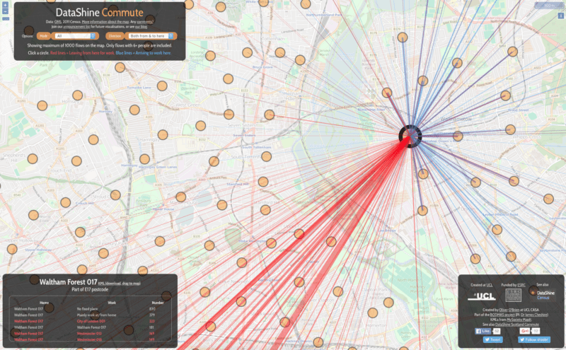
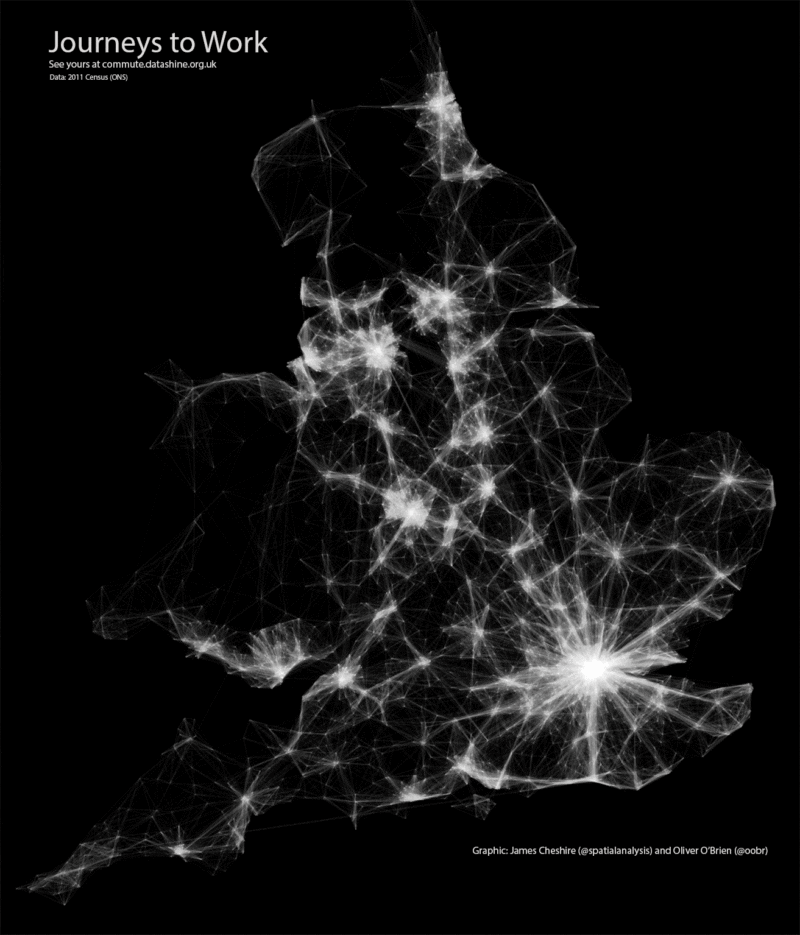
Datashine: Mapping the UK Population
Sep 8, 2016
Mapping Flows in R
Mar 30, 2015
1
2
3
Next Page