The late Roger Tomlinson is considered the “Father of Geographic Information Systems” and he completed his PhD in the UCL Department of Geography in 1974. Tomlinson pioneered digital mapping – every map created using a computer today still uses the principles he laid down in his thesis and its associated work creating the “The Canada Geographic Information System“. I’m pleased to say that after over four decades of sitting on a shelf within the department we now have it fully digitised (and OCRed so it’s searchable) and available to download here.
The thesis is entitled “Geographical Information Systems, Spatial Data Analysis and Decision Making in Government” and it’s remarkably timeless in its content. So many of Tomlinson’s principles apply today – not just in his conception of the flow and types of spatial data elements…
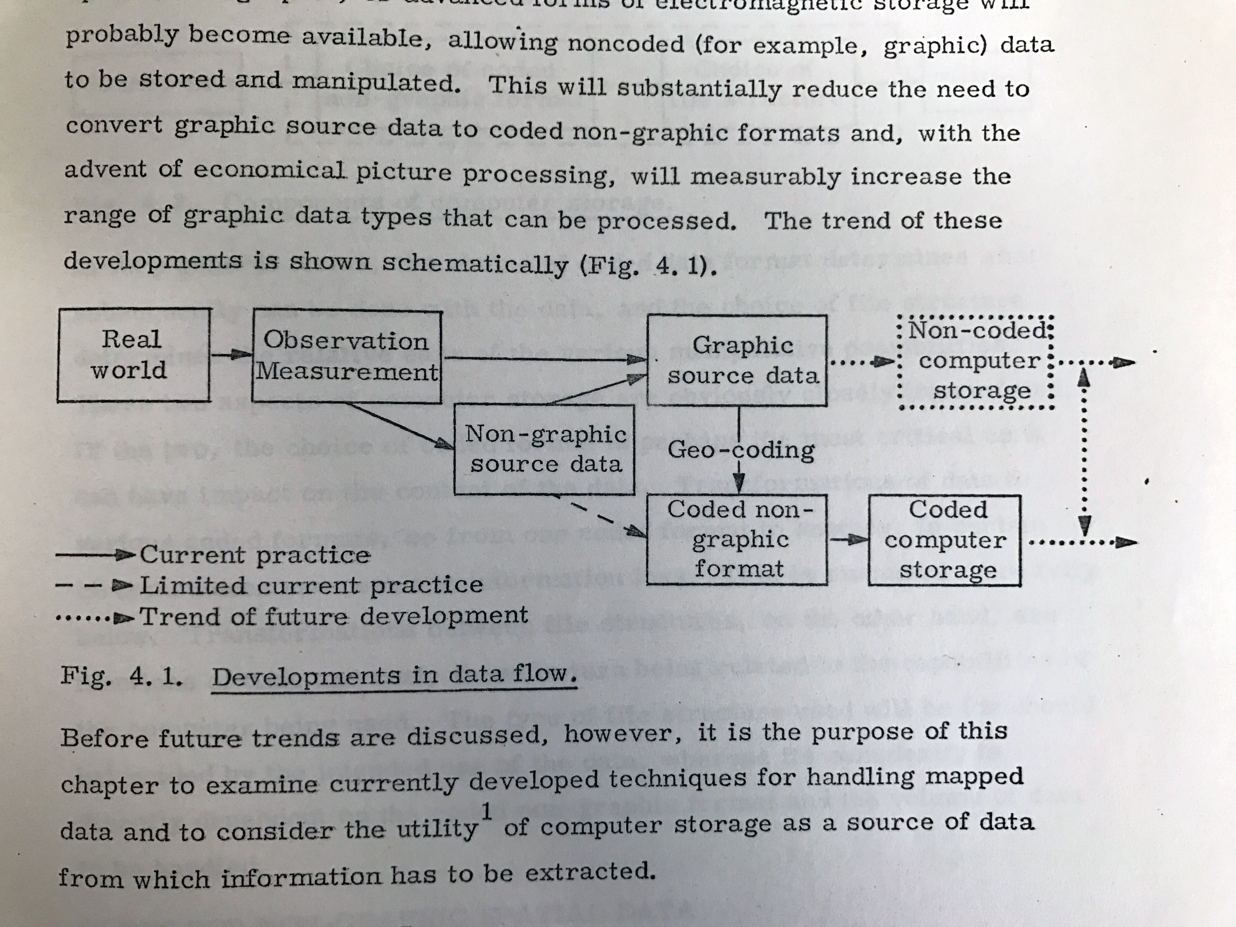
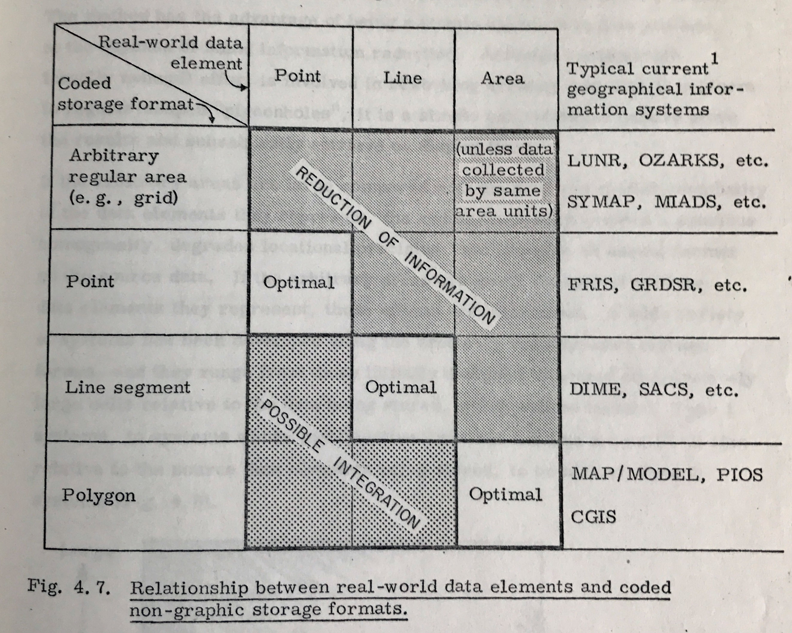
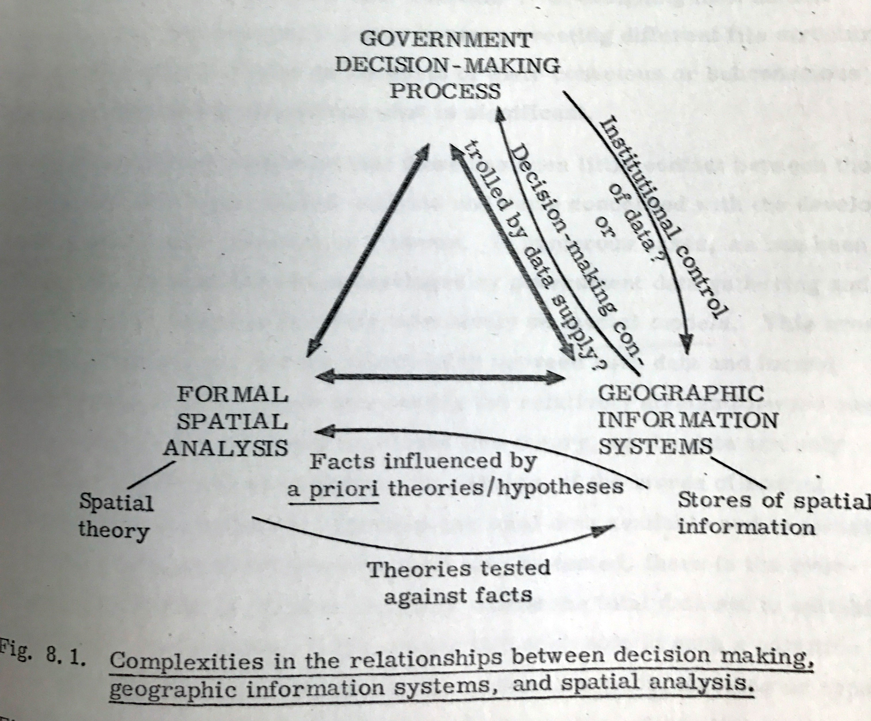
…but also in the governance and impact of geographic data in the real world.
 The maps themselves are amongst the first to showcase the value of combining spatial data for insight – in this case for the identification of areas with high potential for particular land uses given a list of priorities.
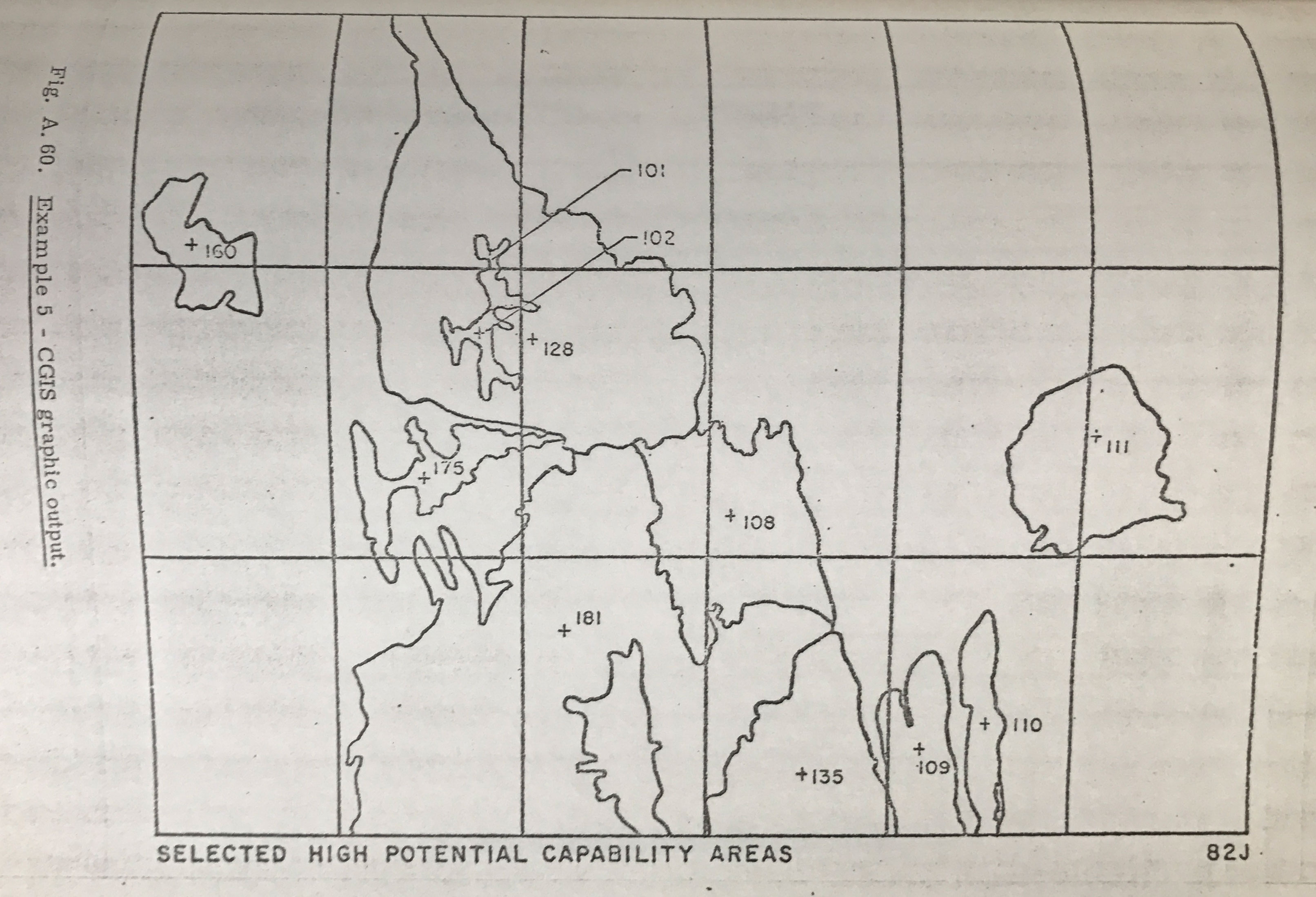
I was relieved to see that some things have changed since Tomlinson’s time as a PhD student. The thesis contains various tables of the costs – both in terms of person hours and $$ – for the various calculations required for his system. For example measuring the areas and perimeters of a few thousand polygons took 11.5 days (programming + processing) and cost $650 in CPU time!
Anyone working with spatial data should read this work at least once, if only because when we sought consent to post the work online Roger’s wife Lila said “I’m glad to hear that it will be disseminated far and wide”. Here’s the link again.
Roger Tomlinson's PhD: The first in GIS

James Cheshire is Professor of Geographic Information and Cartography in the UCL Department of Geography and the inaugural director of the UCL Social Data Institute. A world-leading map maker and geographer, his cartographic creations have been enjoyed by millions.