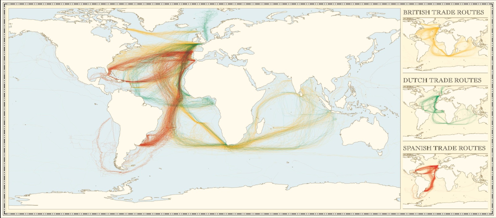
One of the most popular set of maps I produced last year showed English, Spanish and French Shipping between 1750-1800. I am pleased to say it has been revamped and published in a book entitled “The Infographic History of the World“. Valentina D’Efilippo did the redesign from the basic maps I created to put all three maps on a single page and James Ball provided the text.
“A project looking at climate change in the world’s oceans gathered an array of location information from the logbooks of British (yellow), Spanish (red) and Dutch (green) ships between 1750 and 1850 – and James Cheshire of University College, London, assembled the first 50 years of that information into this amazing graphic. It tells us that all three nations were eager and frequent travellers between the old and new worlds for trade, but while Spain frequented both North and South America, the Dutch stuck largely to the South (and the Caribbean), and the British focused far more on the North.”
If you want to find out more about this fascinating dataset please see the original post. There is quite a nice animation acssociated with the book here:
Updated: Colonial Shipping Routes

James Cheshire is Professor of Geographic Information and Cartography in the UCL Department of Geography and the inaugural director of the UCL Social Data Institute. A world-leading map maker and geographer, his cartographic creations have been enjoyed by millions.