James Cheshire
About
Blog
Teaching
Papers
Tag:
stats
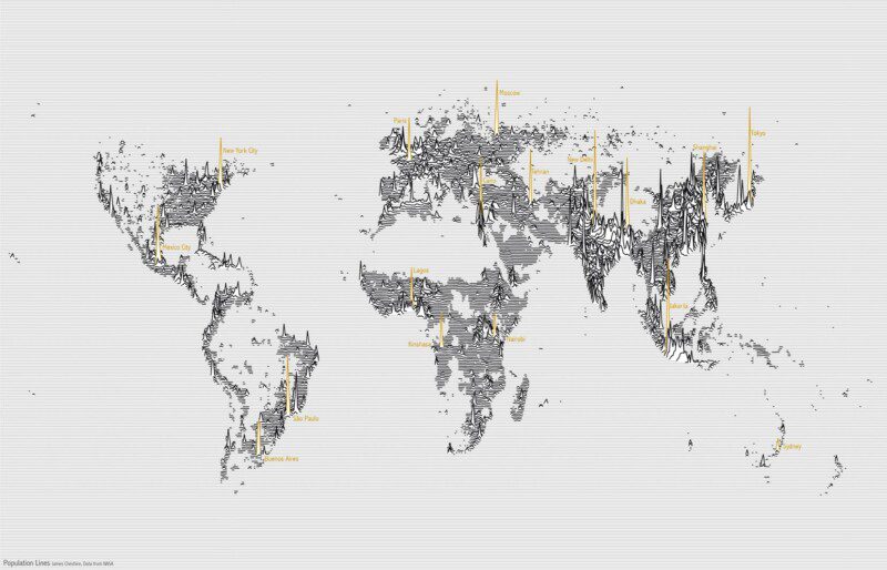
Population Lines: How and Why I Created It
Apr 27, 2017
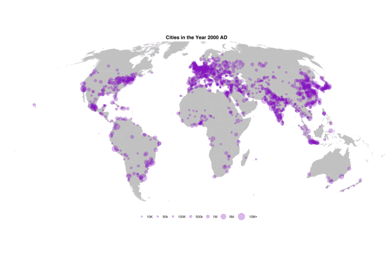
Mapping 5,000 Years of City Growth
Mar 6, 2017
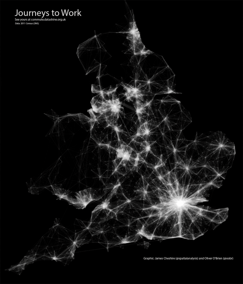
Mapping Flows in R
Mar 30, 2015
Great Maps with ggplot2
Feb 2, 2012
Exporting KML from R
Jan 3, 2011