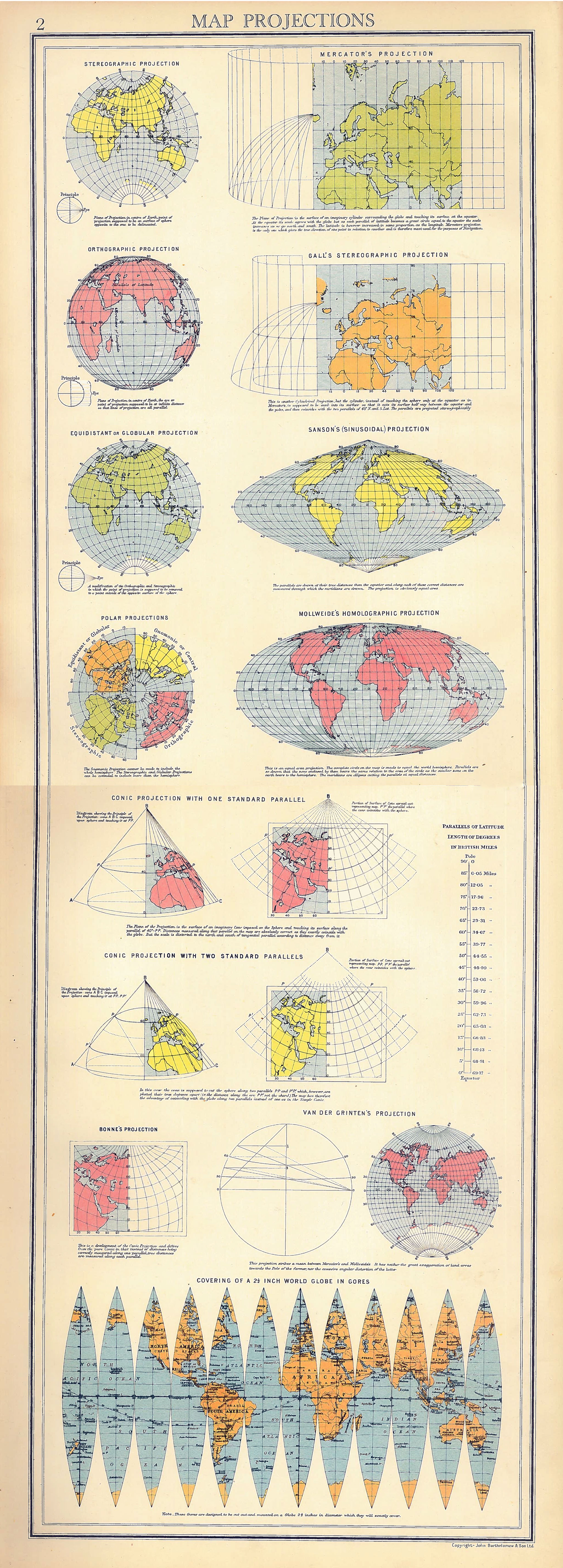
I’ve just discovered this really lovely graphic detailing a number of different map projections. It’s taken from the opening pages of the “Oxford Advanced Atlas” (Bartholomew, 1936) and features well-known projections such as the Mercator and Mollweide, through to the more obscure Van der Grinten, and the heart shaped Bonne. It even features the gores required to make your own globe! I’ve scanned and combined the pages to make them scrollable.
I wish I’d seen this before I did something similar (but much less informative) a few weeks ago…!

Map Projections
Tags

James Cheshire is Professor of Geographic Information and Cartography in the UCL Department of Geography and the inaugural director of the UCL Social Data Institute. A world-leading map maker and geographer, his cartographic creations have been enjoyed by millions.