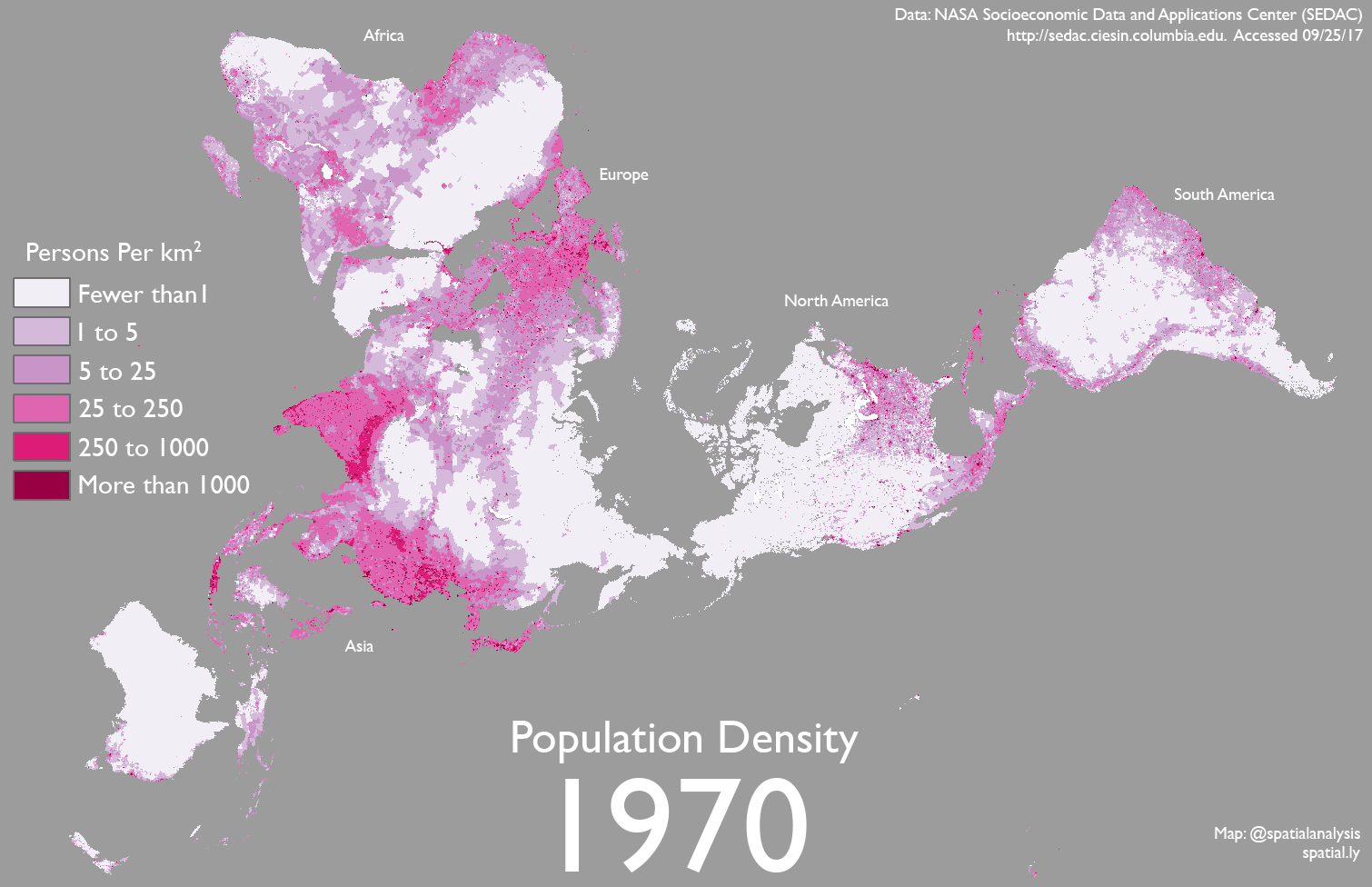
This animation of estimated global population density between 1970-2000 uses data produced by NASA’s SEDAC. For more information see here.
World Population Density 1970-2000
Tags

James Cheshire is Professor of Geographic Information and Cartography in the UCL Department of Geography and the inaugural director of the UCL Social Data Institute. A world-leading map maker and geographer, his cartographic creations have been enjoyed by millions.