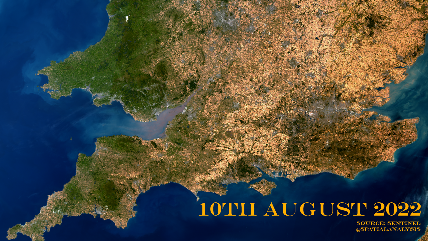
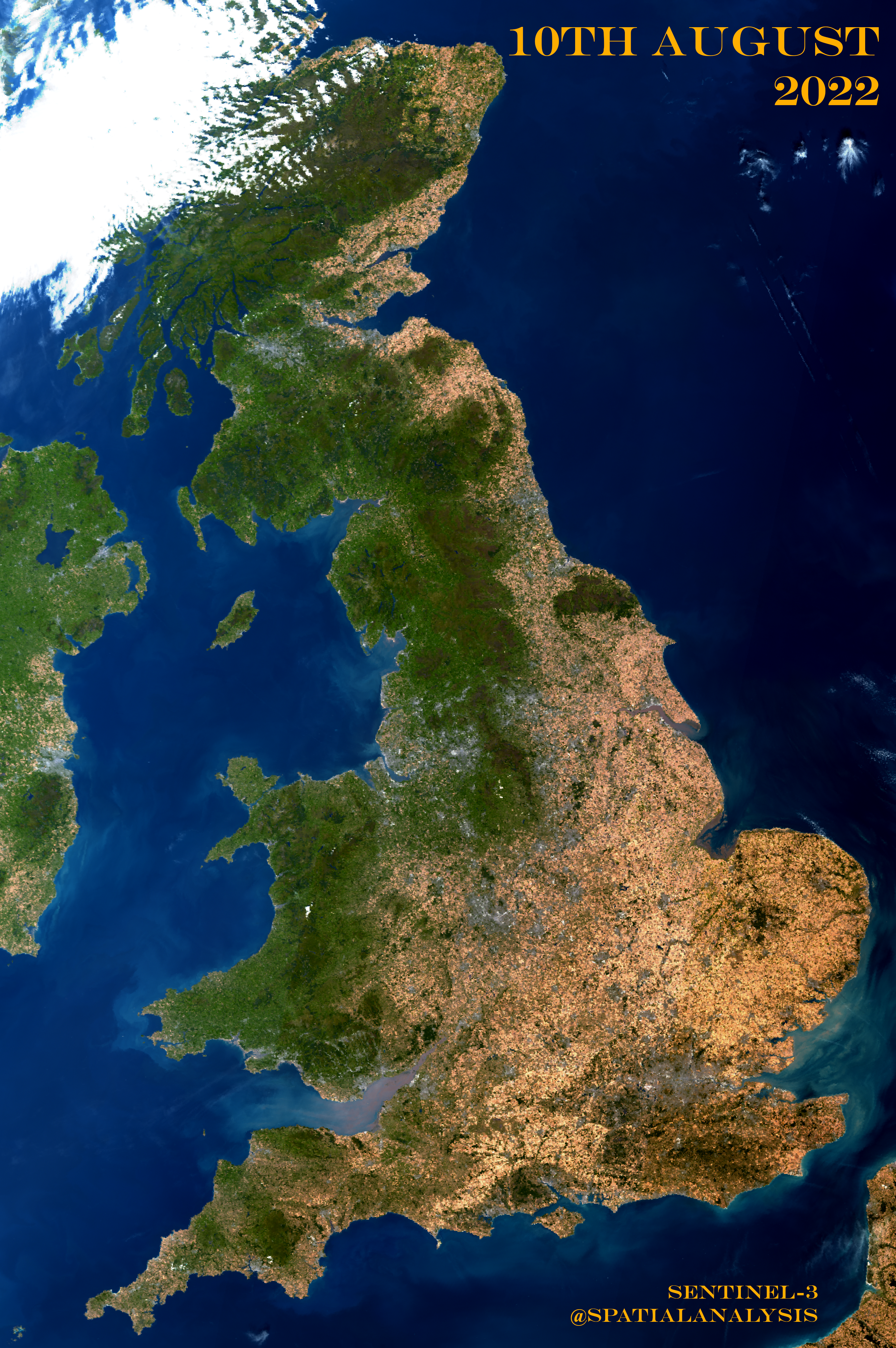
I’ve been obsessively checking satellite imagery to witness the UK turn from green to yellow, thanks to the period of extreme heat and lack of rain Europe has been enduring. The parched landscape is unlike anything I’ve seen before and a cloud free day today (10th August) has revealed the true extent of the drought.
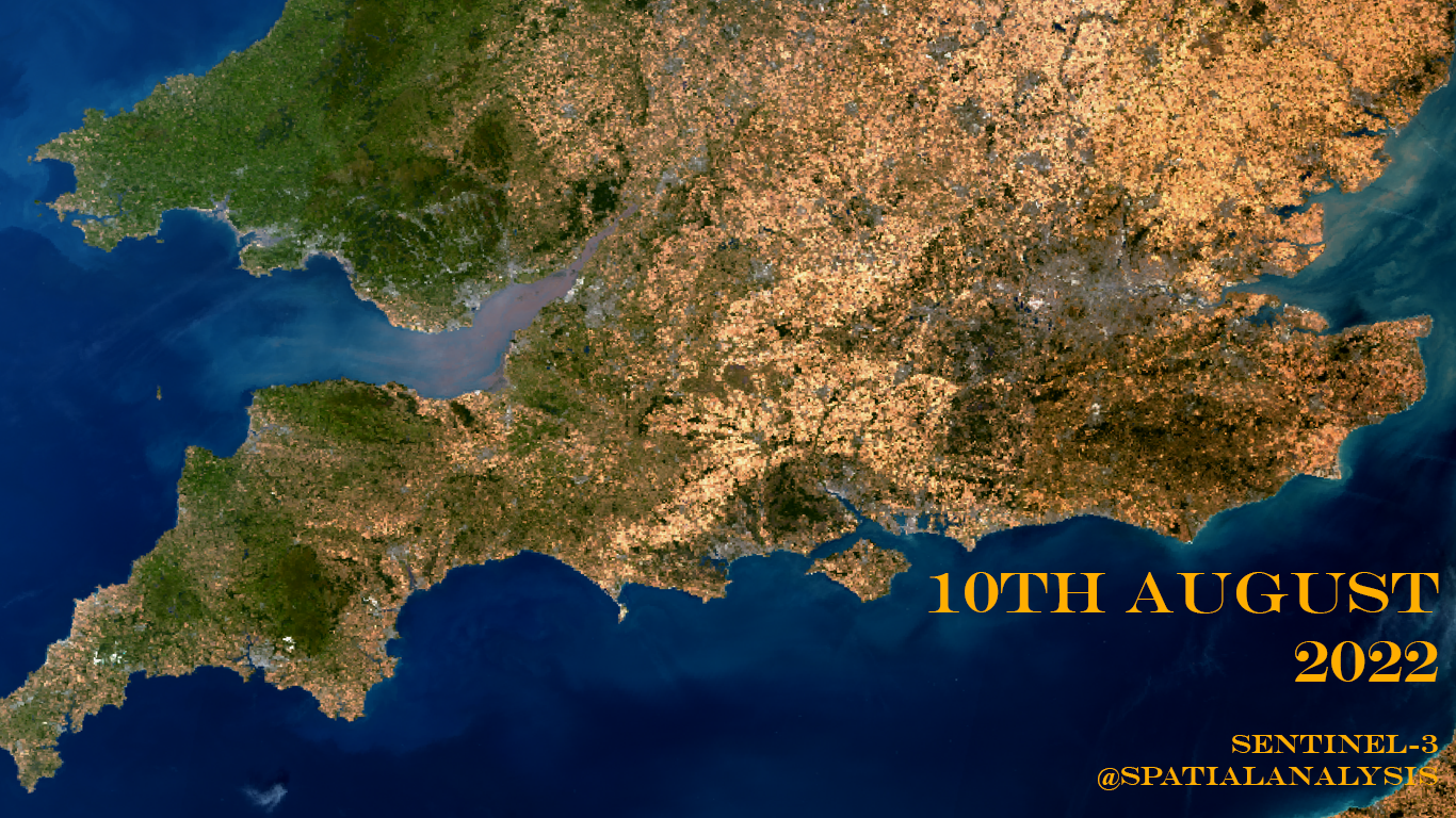
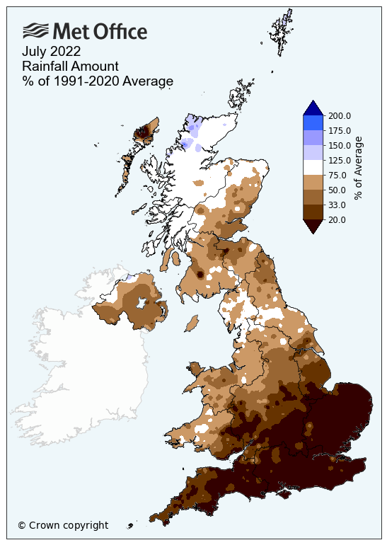
Its shows with extraordinary clarity where the UK gets the most rain (and where some has fallen) thanks to being more to the west or at higher elevations.

The South East has gone from green to yellow and now almost black such is the intensity of the drought. With no significant rain in the forecast and more intense heat in the coming days, its an image that is only going to get more shocking as the summer wears on.
To see and download these images click here.
There’s also a range of educational materials about the climate crisis here.
Footnote: Aren’t crops yellow this time of year?
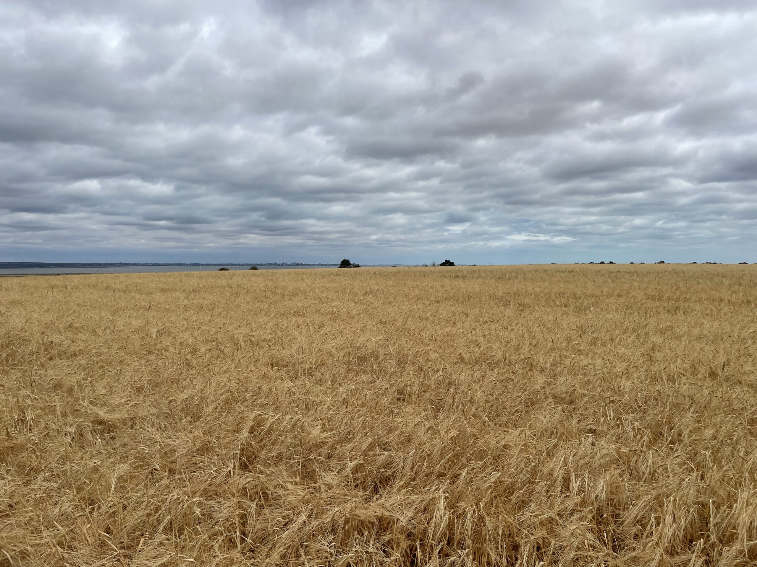
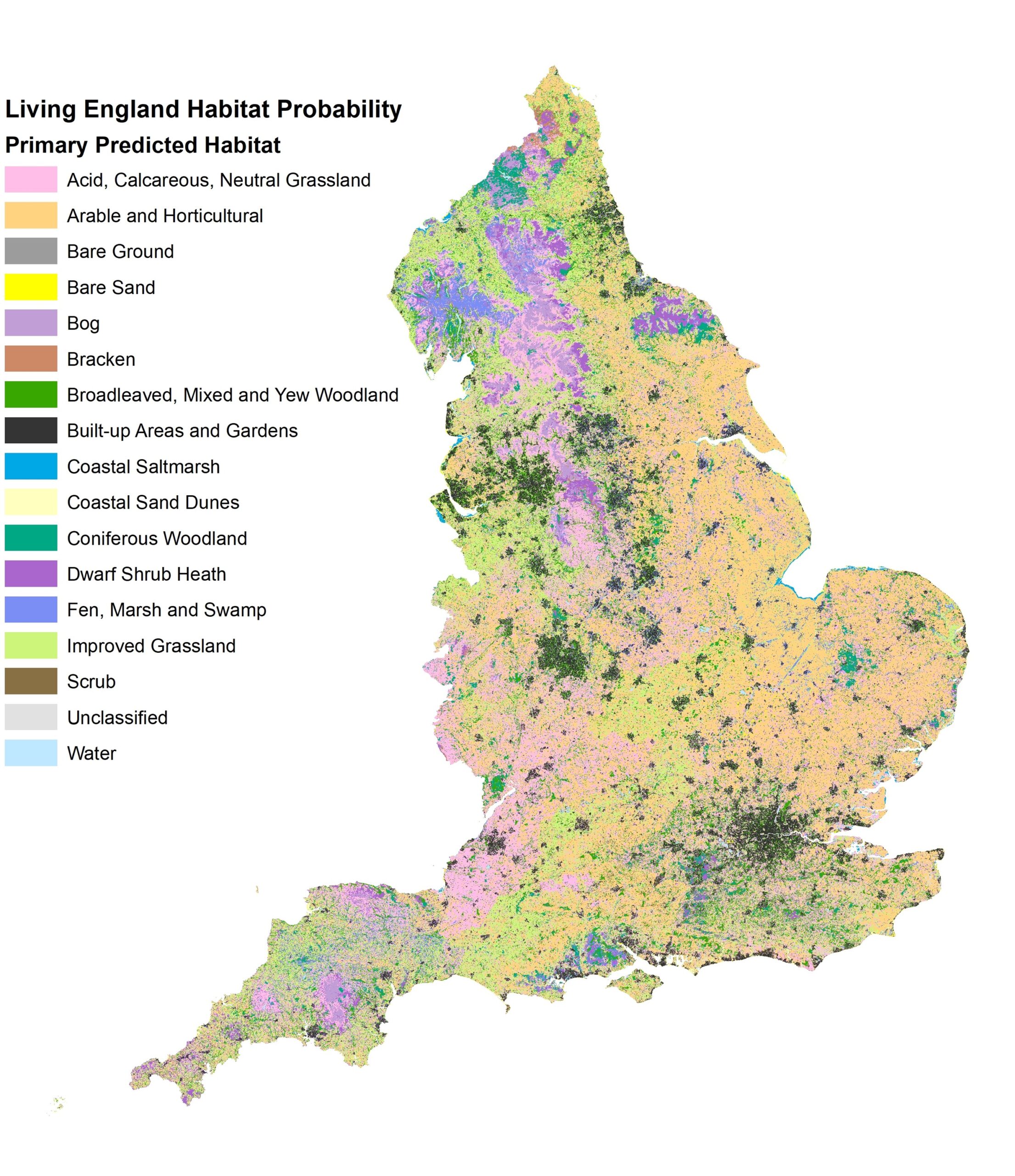
Yes! Of course they are! And there is a distinct geography to the pattern of agriculture that makes the parts that grow crops such as wheat more ‘yellow’ than others, especially to the South and East. Here’s a nice map from Natural England that shows the land uses that can contribute to the different colours we might see in England.
But we’ve had the driest July since 1935, so areas that would hold out as green for most of the summer have now become tinder dry. The rainfall map from the Met Office lines up very well with the most parched areas.
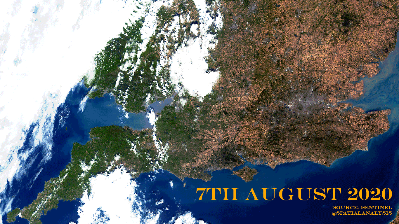
…and finally I went back to the last spell of record breaking weather – August 2020 – and processed the satellite image from the same time (7th August) in the same way as the one above. Here you can see the difference. So even by the standards of previous years of extreme heat, our ‘green and pleasant land’ is looking scorched.