Skip to content
James Cheshire
About
Blog
Teaching
Papers
Category:
Slideshow
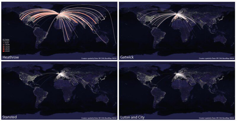
What's so Great About a World Flight Paths Map?
May 30, 2013
Visualising for Human Geography
May 1, 2013
Mapped: Twitter Languages in New York
Feb 20, 2013
Mapped: Twitter Languages in London
Oct 22, 2012
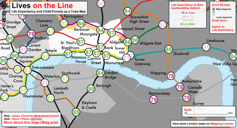
Lives on the Line: Life Expectancy and Child Poverty as a Tube Map
Jul 19, 2012
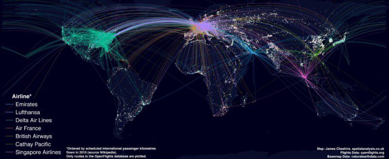
Mapping the World's Biggest Airlines
Jun 7, 2012
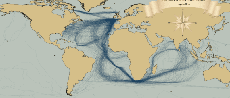
Mapped: British, Spanish and Dutch Shipping 1750-1800
Mar 30, 2012
Previous Page
1
2