Skip to content
James Cheshire
About
Blog
Teaching
Papers
Author:
James Cheshire
The Times Atlas of London
Oct 17, 2011
Mapping Academic Tweets
Oct 10, 2011
Interview for the Global Lab Podcast
Aug 31, 2011
Naming Rivers and Places
Aug 26, 2011
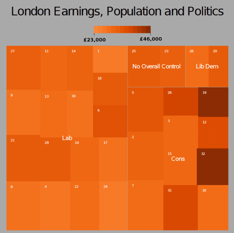
Improved Tree Maps with R
Aug 17, 2011
Mapping GCSE Scores
Aug 16, 2011
England Riots: Offences Committed and Offenders Age
Aug 16, 2011
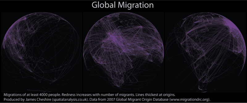
Global Migration Maps
Mar 17, 2011
Flattening the Earth
Mar 7, 2011
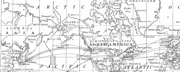
World Transport Links and US Climate from The National Geographic over a Century ago
Mar 2, 2011
Previous Page
1
…
9
10
11
12
13
Next Page