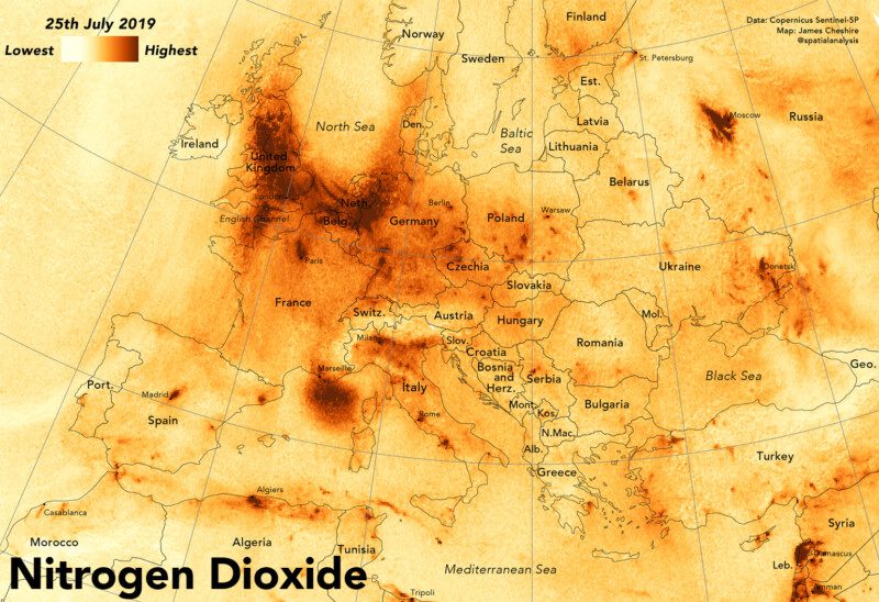
Here is a short video I did for the Royal Geographical Society to show how new satellite data can reveal the daily changes to nitrogen dioxide (and other pollutants) in the atmosphere in unprecedented detail. For a longer version of the video and further explanation see here.
Mapping Nitrogen Dioxide Across Europe
