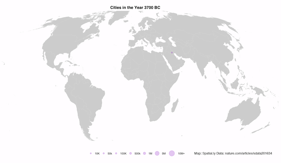
 I recently stumbled upon a great dataset. It’s the first to provide comprehensive data for world city sizes as far back as 3700BC. The authors (Meredith Reba, Femke Reitsma & Karen Seto) write:
How were cities distributed globally in the past? How many people lived in these cities? How did cities influence their local and regional environments? In order to understand the current era of urbanization, we must understand long-term historical urbanization trends and patterns. However, to date there is no comprehensive record of spatially explicit, historic, city-level population data at the global scale. Here, we developed the first spatially explicit dataset of urban settlements from 3700 BC to AD 2000, by digitizing, transcribing, and geocoding historical, archaeological, and census-based urban population data previously published in tabular form by Chandler and Modelski.
These kinds of data are crying out to be mapped so that’s what I did…
Read more (and get the R code)
Mapped: 5,000 Years of City Growth
Tags

James Cheshire is Professor of Geographic Information and Cartography in the UCL Department of Geography and the inaugural director of the UCL Social Data Institute. A world-leading map maker and geographer, his cartographic creations have been enjoyed by millions.